


SIOUX CITY PCT 10, Woodbury County, Iowa
About
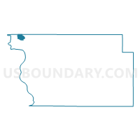
Outline

Summary
| Unique Area Identifier | 583812 |
| Name | SIOUX CITY PCT 10 |
| County | Woodbury County |
| State | Iowa |
| Area (square miles) | 3.29 |
| Land Area (square miles) | 3.29 |
| Water Area (square miles) | 0.00 |
| % of Land Area | 99.98 |
| % of Water Area | 0.02 |
| Latitude of the Internal Point | 42.54694130 |
| Longtitude of the Internal Point | -96.41075860 |
Maps


Graphs
Select a template below for downloading or customizing gragh for SIOUX CITY PCT 10, Woodbury County, Iowa


Neighbors
Neighoring Voting District (by Name) Neighboring Voting District on the Map
- PERRY TWP W/SIOUX CITY PART Voting District, Plymouth County, IA
- SIOUX CITY PCT 1, Woodbury County, IA
- SIOUX CITY PCT 17, Woodbury County, IA
- SIOUX CITY PCT 19, Woodbury County, IA
Top 10 Neighboring County Subdivision (by Population) Neighboring County Subdivision on the Map
- Sioux City city, Woodbury County, IA (82,678)
- Perry township, Plymouth County, IA (1,124)
- Sioux City city, Plymouth County, IA (6)
Top 10 Neighboring Place (by Population) Neighboring Place on the Map
Top 10 Neighboring Unified School District (by Population) Neighboring Unified School District on the Map
Top 10 Neighboring State Legislative District Lower Chamber (by Population) Neighboring State Legislative District Lower Chamber on the Map
- State House District 3, IA (29,741)
- State House District 1, IA (29,391)
- State House District 2, IA (27,840)
Top 10 Neighboring State Legislative District Upper Chamber (by Population) Neighboring State Legislative District Upper Chamber on the Map
Top 10 Neighboring 111th Congressional District (by Population) Neighboring 111th Congressional District on the Map
Top 10 Neighboring Census Tract (by Population) Neighboring Census Tract on the Map
- Census Tract 2, Woodbury County, IA (6,505)
- Census Tract 3, Woodbury County, IA (6,097)
- Census Tract 9706, Plymouth County, IA (5,392)
- Census Tract 4, Woodbury County, IA (4,579)